Road Defect Detection (Smartphone)
Mobile Sensor-Based Road Monitoring System
September 2019
Private Repository
Overview
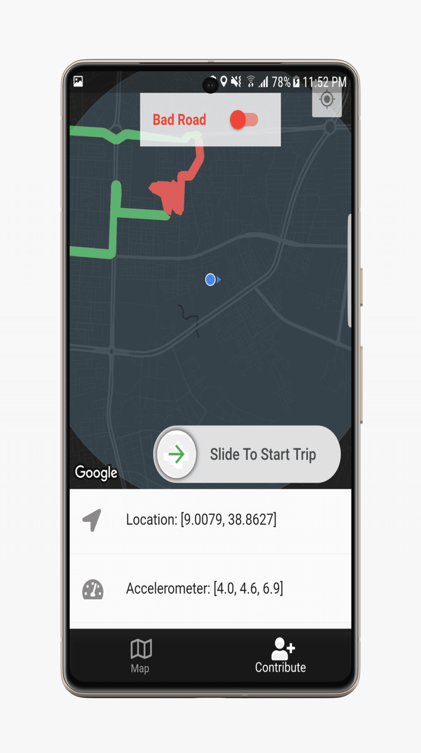
This project introduces an innovative road defect detection system that utilizes smartphone sensors to monitor road conditions in real-time. By analyzing data from the accelerometer and gyroscope, the system can classify road surfaces and generate insights into road quality. This information can be visualized on a map, aiding both drivers and road authorities in decision-making.
Key Features
- Real-Time Road Classification: Detects road irregularities using accelerometer and gyroscope readings from a smartphone.
- Data-Driven Insights: Aggregates sensor data to create a road condition heatmap, identifying areas that need maintenance.
- Machine Learning-Based Classification: Utilizes Support Vector Machine (SVM) and Multi-Layer Perceptron (MLP) models to classify road conditions accurately.
- User-Driven Labeling: Enables manual annotation of road conditions through a mobile app, improving data quality.
- Scalable and Cost-Effective: Operates on smartphones, eliminating the need for expensive hardware installations.
Technical Implementation
- Sensor Data Processing:
- Collects accelerometer (X, Y, Z) and gyroscope (X, Y, Z) data at 5 readings per second.
- Uses StandardScaler normalization for improved model performance.
- Machine Learning Models:
- Support Vector Machine (SVM) for initial classification.
- Multi-Layer Perceptron (MLP) with three hidden layers for enhanced accuracy.
- Mobile App for Data Collection:
- Built using Flutter and Dart for a smooth cross-platform experience.
- Allows users to annotate road conditions, improving dataset reliability.
- Backend & Database:
- Python backend for data processing.
- MongoDB for storing road condition data and historical records.
Business Impact
This system provides critical benefits for both individual drivers and government authorities:
- Drivers can receive real-time alerts about road conditions, enabling safer and more comfortable travel.
- Road Authorities can use the aggregated data to prioritize maintenance and reconstruction efforts, leading to cost-effective infrastructure planning.